Dune Monitoring survey (2011-2012)
Ten Annex I sand dune habitats occur in Ireland, of which four are considered priority habitats. Under Article 17 of the EU Habitats Directive, Irelandis required to monitor and report the conservation status of these habitats every six years. A baseline survey was undertaken from 2003 to 2006 in order to establish the condition of Irish sand dune habitats and the area they covered at the time (Ryle et al., 2009, see below). The data provided the basis for the first Article 17 report in 2007. The current project constitutes the first round of monitoring for dune habitats. The project began in 2011 and will be completed in 2012. The data collected will be used to report on the status of Annex I dune habitats for the next Article 17 report, which is due in 2013.
Forty sites have been selected as being representative of the variation found in sand dune habitats in Ireland. The sites are distributed around the coast of Ireland and range in size from 5ha to 460ha. Comparisons will be made with data from the baseline survey and conservation assessments will be made of each Annex I habitat at each site based on (a) change in area, (b) structure & function and (c) future prospects. An assessment of the condition of the habitats on a national basis will also be made, taking into account changes in range. A database containing the results of the conservation assessments from both the baseline survey and the first round of monitoring will be compiled.
| Forty sites have been selected as being representative of the variation found in sand dune habitats in Ireland. The sites are distributed around the coast of Ireland and range in size from 5ha to 460ha. Comparisons will be made with data from the baseline survey and conservation assessments will be made of each Annex I habitat at each site based on (a) change in area, (b) structure & function and (c) future prospects. An assessment of the condition of the habitats on a national basis will also be made, taking into account changes in range. A database containing the results of the conservation assessments from both the baseline survey and the first round of monitoring will be compiled. |
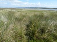
Lough Banna (Photo: NPWS) |
Sea Cliff survey
|
A national inventory of Irish sea cliff and coastal heath sites is underway. A total of 140 potential sites have been identified, with concentrations in Donegal, Mayo, Kerry and Cork. A detailed field survey has just commenced. |
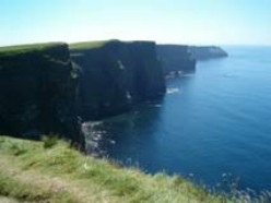
Sea cliff (Photo: Karen Gaynor) |
Coastal Monitoring Project 2004-2006
This national survey of Irish sand dunes was carried out on behalf of the National Parks and Wildlife Service (NPWS). The project represents the first comprehensive survey and assessment of sand dune systems and their habitats in Ireland. Over the course of three field seasons (2004-2006), almost 180 coastal sites were surveyed in detail. A habitat map was produced for each site and the conservation status of each habitat present was assessed. The total remaining dune resource is now estimated to cover approximately 10,850ha. The data were summarised to give a national overview of each habitat.
The project involved developing a survey methodology to assess the conservation status of dune habitats and provides important baseline data that can be used for monitoring sites in the future. The survey was specifically designed to produce data that could be used to report on the conservation status of ten Annex I sand dune habitats in Ireland under Article 17 of the EU Habitats Directive. It should be noted, however, that in the case of the two dune heath habitats the results of the conservation assessments in the CMP do not comply with the final Article 17 report submitted to the European Commission.
The conclusions drawn in this survey are those of the survey team and should not be inferred to represent those of NPWS. Readers are advised to examine the full report cited below before using the information.
A Summary of findings of CMP ![]() [68KB] outlining the main findings of the research is available, or you can download the main report below:
[68KB] outlining the main findings of the research is available, or you can download the main report below:
Ryle, T., Murray, A., Connolly, C., & Swann, M. (2009) Coastal Monitoring Project 2004-2006 ![]() [2.66MB], Unpublished Report to the National Parks & Wildlife Service.
[2.66MB], Unpublished Report to the National Parks & Wildlife Service.
Saltmarsh survey
 |
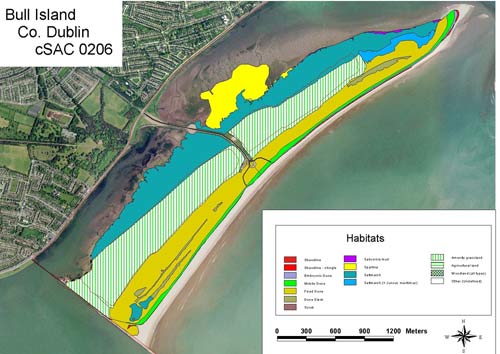
The conservation status of saltmarsh habitats is currently being assessed. A series of monitoring stops have been visited to assess various attributes such as typical species or negative indicators. The extent of each habitat is mapped and the impacts and activities recorded. Habitat Map for Bull Island, Special Area of Conservation, Co. Dublin |
McCorry, M. & Ryle, T. (2009) Saltmarsh Survey Report 2009 - Volume 1 ![]() [5MB], Unpublished Report to the National Parks & Wildlife Service.
[5MB], Unpublished Report to the National Parks & Wildlife Service.
Members of the Scientific Unit can be contacted by e-mailing: natureconservation@npws.gov.ie


